Contents
Index
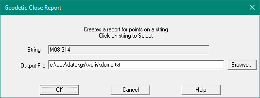
Geodetic Close Report
Print a report of the co-ords, grid bearing, mid azimuth (true mid bearing,
grid distance, ground distance between the string points.
It also includes point grid coordinates, and latitude and longitude.
String
The String selected for the report.
To select a string, click the mouse on a string in the main window.
Any string is acceptable for the report:
Data Columns
- Point number
- Easting
- Northing
- Height, or blank
- Latitude, Longitude
- Convergence
- Grid Bearing for segment
- Grid Distance for segment
- Mid Azimuth (true mid bearing) for the segment
- Spheroidal Angle
- Ground Distance for segment
- Total Spheroidal Angle
- Area of the parcel if closed
Report
GeoSurvey V8.10  Geodetic Close Report  dome.acs  06-Apr-2021 18:49:59
Job: dome.acs,  String: M08-314  Datum: GDA_1994/Zone_50
                 MGA Coordinates      Spheroidal
  Point       Easting      Northing   Height        Latitude          Longitude            Convergence
      1    352865.596   7479752.061               -22°46'59.999988"  115°34'00.000006"     0°33'18.56"
      2    351154.475   7479735.384               -22°46'59.99999"  115°33'00.00001"     0°33'41.80"
      3    349443.345   7479718.515               -22°46'59.99999"  115°32'00.00000"     0°34'05.05"
      4    349425.054   7481563.884               -22°45'59.99999"  115°32'00.00000"     0°34'03.64"
      5    349563.104   7481565.244               -22°46'00.00022"  115°32'04.84007"     0°34'01.76"
      6    349561.679   7481709.102               -22°45'55.32283"  115°32'04.84002"     0°34'01.65"
      7    351273.026   7481725.967               -22°45'55.32214"  115°33'04.83981"     0°33'38.42"
      8    352984.364   7481742.640               -22°45'55.32140"  115°34'04.83957"     0°33'15.19"
      9    353002.243   7479897.271               -22°46'55.32208"  115°34'04.84033"     0°33'16.57"
     10    352864.202   7479895.925               -22°46'55.32238"  115°34'00.00001"     0°33'18.45"
      1    352865.596   7479752.061               -22°46'59.99999"  115°34'00.00001"     0°33'18.56"

   From      To     Grid-Bearing    Grid-Distance      Mid-Azimuth  Spheroidal-Angle   Ground-Distance
      1       2  269°26'29.8191"         1711.202  270°00'00.0000"                             1711.424
                                                                     180°00'23.2349"
      2       3  269°26'06.5714"         1711.213  270°00'00.0001"                             1711.424
                                                                      90°00'11.6175"
      3       4  359°25'55.6556"         1845.460    0°00'00.0000"                             1845.681
                                                                      89°59'48.4762"
      4       5   89°26'07.8882"          138.057   90°00'10.5874"                              138.073
                                                                     270°00'11.7120"
      5       6  359°25'56.2319"          143.865  359°59'57.9390"                              143.883
                                                                      89°59'48.8791"
      6       7   89°26'07.4145"         1711.431   89°59'57.4512"                             1711.642
                                                                     179°59'36.9829"
      7       8   89°26'30.4445"         1711.419   89°59'57.2509"                             1711.641
                                                                      89°59'48.0636"
      8       9  179°26'41.6959"         1845.456  179°59'57.5786"                             1845.702
                                                                      90°00'12.4127"
      9      10  269°26'28.5913"          138.047  269°59'46.1029"                              138.065
                                                                     269°59'47.0407"
     10       1  179°26'41.4963"          143.871  179°59'59.9995"                              143.890
                                                                      90°00'11.6169"

                                            Total Spheroidal Angle = 1440°00'00.0359"
                                                 Total (Grid) Area = 704.3639 Hectares